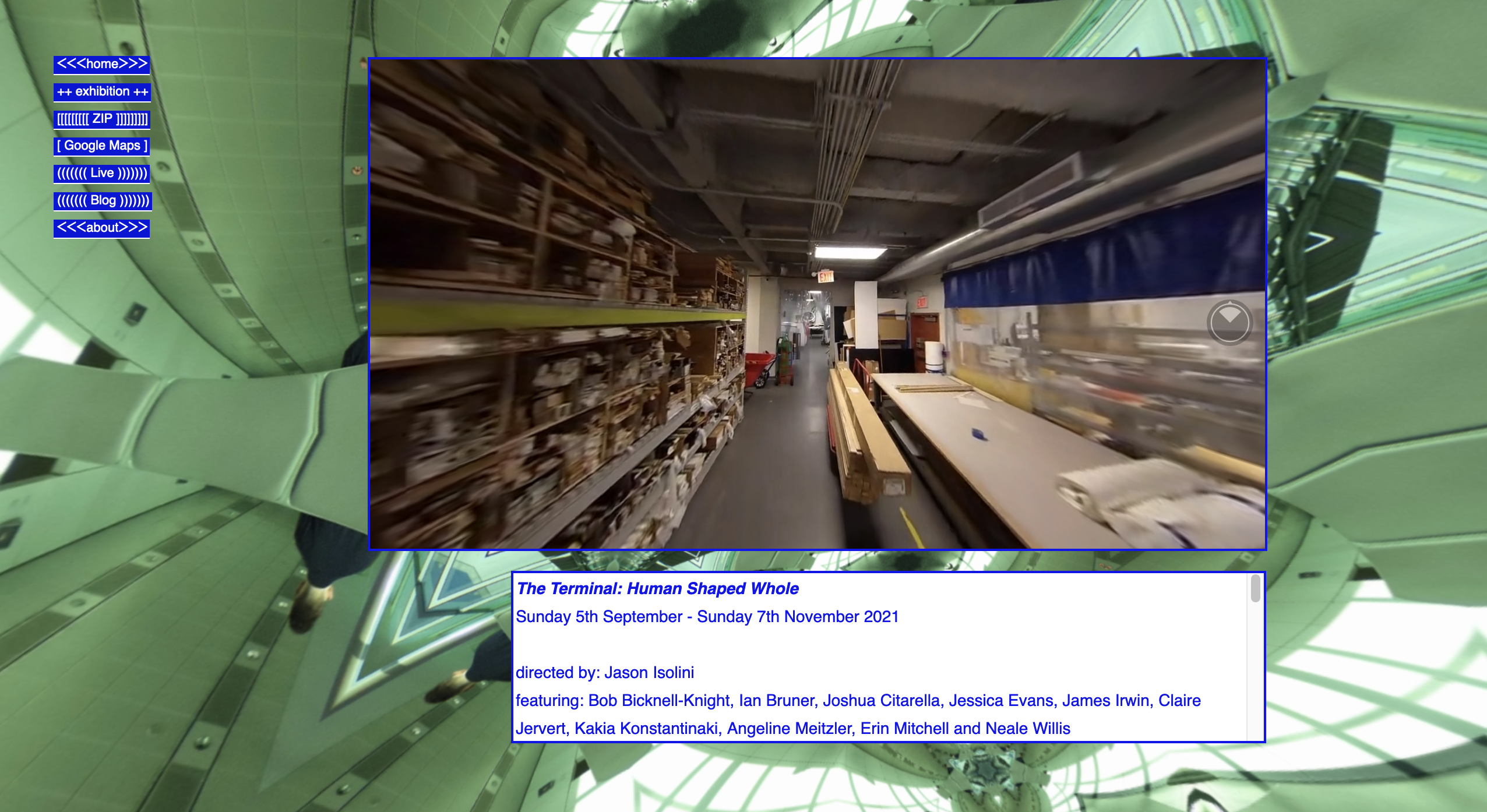
Progetti taggati: INFRASTRUTTURA # Google Maps
DESCRIZIONE |
Google Maps è una piattaforma di mappatura web e un’applicazione per consumatori di proprietà di Google. Fornisce immagini satellitari, fotografie aeree, mappe stradali, viste panoramiche interattive a 360° delle strade (Street View), condizioni del traffico in tempo reale, e pianificazione dei percorsi per viaggiare a piedi, in auto, in aereo (in beta) e con i trasporti pubblici. È stata lanciata nel 2005. |
FATTI (alcuni) |
|
[:it] 1# Il servizio è iniziato come un programma C++ progettato da Lars e Jens Eilstrup Rasmussen, Noel Gordon e Stephen Ma presso la società Where 2 Technologies di Sydney. Fu inizialmente progettato per essere scaricato direttamente dagli utenti. In Ottobre del 2004, l'azienda è stata acquisita da Google Inc. 2# My Maps è una funzione di Google Maps lanciata in Aprile del 2007 che permette agli utenti di creare mappe personalizzate per uso personale o per la condivisione. 3# In Ottobre del 2009, Google ha sostituito Tele Atlas come fornitore principale di dati geospaziali nella versione statunitense di Maps e ha utilizzato i propri dati. 4# Nel febbraio 2020, Simon Weckert ha usato 99 telefoni cellulari per simulare un imbottigliamento del traffico su Google Maps. [:en]1# The service first started as a C++ program designed by Lars and Jens Eilstrup Rasmussen, Noel Gordon and Stephen Ma at the Sydney-based company Where 2 Technologies. It was first designed to be downloaded by users. In October 2004, the company was acquired by Google Inc. 2# My Maps is a feature in Google Maps launched in April 2007 that enables users to create custom maps for personal use or sharing. 3# In October 2009, Google replaced Tele Atlas as their primary supplier of geospatial data in the US version of Maps and used their own data. 4# In February 2020, Simon Weckert used 99 cell phones to fake a Google Maps traffic jam. [:] |